By MMC Club Rider Michael Hicks
Since retiring in July, 2015, my wife and I have been spending most of our time in Durango, Colorado. Durango has a reputation for being a mountain bike town with many big name pros past and current living in the area. We live 10 miles north of Durango in the Hermosa area.
The Lower Hermosa Creek trailhead is only 4 miles from my house and I spend a lot of days riding the road up to the trailhead and doing an out and back on the Hermosa Creek Trail or the Jones Creek Trail which starts in the same area. The Hermosa Creek Trail from the lower end is pretty moderate with equal amounts of climbing and descending through heavy forest. Hermosa Creek Trail and Jones Creek are open to motorcycles, no ATV’s, so don’t be surprised.
The Hermosa Creek Trail is a 20+ mile trail that is usually ridden as a through ride starting at the Upper Hermosa Creek campground and ending at the Lower Campground. This requires a car shuttle or a long ride back up the hill to your car, not recommended. The trail is remote and follows the creek for the first part and then climbs up the side of the canyon away from creek. While it is generally downhill, there are significant climbs, particularly after crossing Little Elk Creek. This ride usually takes me about 6 hours to do at a casual pace. This is a very remote ride and there is no road access except at each end. Be prepared and plan for adverse weather.
Jones Creek Trail starts at the Lower Hermosa Campground and climbs up the side of the mountain to the north. The trail starts at 7600’ elevation and terminates at the Pinkerton – Flagstaff trail at about 9800’. It is a steady climb through heavy forest and can be pretty challenging, particularly due to the elevation. The descent back to the trailhead is a lot of fun. Additional options can be done by continuing on the Pinkerton-Flagstaff trail in either direction.
In Durango there are several options for great rides that can all be accessed by bike if you are staying in town.
Horse Gulch – Telegraph Trail area is on the south side of Durango and can be accessed at several trailheads. This area is well signed and generally there are maps at the trail junctions to help you find your way. There are a lot of miles of trail in this area and you can make the ride as long or short as you want.Ride Sugar Trail to the top of Raider Ridge for great views of Durango and the surrounding mountains.
Test Tracks / OverendMtn Park is on the west side of Durango sandwiched between the neighborhoods and Hogsback Mountain and Perrins Peak. Most of the trailheads are located in residential areas. The trail surface here is generally shale which is very smooth and provides great traction. There aren’t a lot of trail miles here and you can ride most of the trails in 1 ½ to 2 hours. Expect a lot of climbing and fast descents. Trail names such as Ned’s Hill, Brown’s Ridge, and Do Drop In give you an idea what to expect.
Twin Buttes is a new residential subdivision in Durango that is just getting started. As part of the development plan the City required the developer to put in a trail system. The trailhead is on Highway 160 about 3 miles west of downtown. There is a Giant station on the right and the parking lot is just past the station. The trail starts out switchbacking up the side of the mountain, so don’t expect any warmup. It is all rideable and very well constructed for bikes. The ride is best done going counterclockwise. After reaching the top, the descent back on Ed & Flo is very fun. It generally takes me 1 ½ hours to do this ride. There are some cross trails that allow shortcuts.
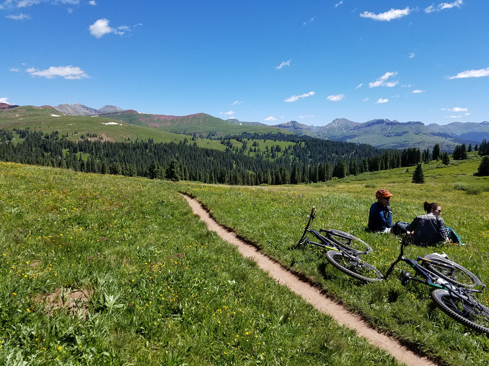
High Alpine Rides – If you go north on Highway 550 from Durango you will go over Coal Bank Pass (10,600’) and then Molas Pass (10,800’). At the top of Molas Pass there is a parking area and the Colorado Trail crosses the highway just below the summit on the Silverton side. This is a spectacular ride which climbs up to above timberline and traverses along the sides of the mountains just below the peaks. The views are superb and the trail is great. It is a good out and back ride or if you plan a shuttle, you can ride the Colorado Trail until it intersects the Engineer Mountain Trail. Turn left on the Engineer Mountain Trail which will pass over the shoulder of Engineer Mountain at 11,800’ and then descend to the bottom of Coal Bank pass at 9000’. This is a great 6 mile downhill through the forest with some amazing views. This is only a 20 mile ride but has taken me 6 hours both times that I have done it.
Another option is to start at the top of Coal Bank Pass and climb Pass Creek Trail to the Engineer Mountain Trail and do the descent. This is a local favorite, but one of the drawbacks is that Pass Creek is a very popular hiking trail and can be pretty busy. Pass Creek is mostly rideable but there are some hike-a-bike sections. This ride usually takes me 2 hours, an hour of climbing and an hour of descending. We use a shuttle to get back to the top of Coal Bank but a lot of people ride the road to retrieve their vehicles.
There are lots of other riding options in the area, particularly on the Colorado Trail from Junction Creek and various segments that can be done with a car shuttle.
MTB Project is a great resource for finding trailheads and navigating the trails. The trail organization in Durango is “Trails 2000” and their website has a lot of good information and a GIS map of all trails in the area.
Other activities to do in the area include rafting and kayaking on the Animas river, riding the Durango Silverton Narrow Gauge Railroad, and visiting Mesa Verde National Park. Also, the drive from Durango to Ouray is one you shouldn’t miss.
Durango claims to have the second highest ratio of restaurants to population in the US, San Francisco having the highest. So there are many great places to eat. My favorites are Carvers and Steamworks (both brew pubs) and Gazpachos, Nayarit, and Zia Taqueria for Mexican. Fine dining fare I would recommend Seasons, Ken & Sues, and Eolus.
